Mapping the Future: Highland Park’s ArcGIS Enterprise Implementation Story
Implementation Process
The implementation process commenced with Highland Park’s decision to outsource GIS services, recognizing the expertise and resources offered by NewEdge. Through this partnership, Highland Park procured ArcGIS Enterprise, a comprehensive GIS platform, for greater control over their GIS environment. Alongside, the platform was seamlessly deployed in the AWS cloud environment by NewEdge’s team, ensuring both scalability and reliability while prioritizing safety and security measures. Leveraging the robust infrastructure of AWS provides a solid foundation for future growth and expansion.
Solution Development
With the technical framework in place, NewEdge began developing a suite of GIS solutions tailored to Highland Park’s specific requirements. This comprehensive approach encompassed the creation of various components, including:
- Data Repositories: NewEdge designed and implemented data repositories to centralize and organize Highland Park’s spatial data assets efficiently. These repositories serve as the backbone of the GIS ecosystem, facilitating data management and accessibility for stakeholders across the city.
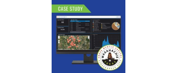
- Web Maps: Interactive web maps were developed to visualize spatial data layers and enable users to explore geographic information intuitively. These maps provide valuable insights into various aspects of Highland Park’s infrastructure, land use, and demographics, empowering decision-makers with actionable intelligence.
- Web Applications: NewEdge developed custom applications tailored to address specific use cases within Highland Park’s operations. These applications leverage the power of GIS technology to streamline workflows, automate processes, and enhance collaboration among different departments.
- Dashboards: Dynamic dashboards were created to visualize key performance indicators and monitor trends in real time. These dashboards offer a consolidated view of spatial data metrics, allowing stakeholders to track progress, identify areas of concern, and make informed decisions based on timely information.
- Field Maps and Survey 123 Applications: Mobile solutions were deployed to facilitate data collection and fieldwork activities. These tools enable field personnel to capture geospatial data accurately, perform inspections, and report observations in a standardized manner, improving efficiency and data quality.
Benefits Realized
The implementation of Highland Park’s GIS project has yielded numerous benefits across various aspects:
- Enhanced Spatial Data Capabilities: The deployment of ArcGIS Enterprise and associated solutions has significantly enhanced Highland Park’s spatial data capabilities, enabling the municipality to leverage geospatial insights more effectively in decision-making processes.
- Improved Accessibility: By centralizing spatial data repositories and deploying user-friendly web maps and applications, Highland Park has improved the accessibility of geospatial information for stakeholders across different departments and levels of expertise.
- Streamlined Workflows: Custom applications and mobile solutions have streamlined workflows and business processes, reducing manual effort, minimizing errors, and increasing operational efficiency within the municipality.
- Real-time Monitoring: Dynamic dashboards provide stakeholders with real-time visibility into key performance metrics, allowing for proactive monitoring of trends, issues, and opportunities affecting Highland Park’s operations.
Future Developments
Moving forward, Highland Park is committed to further enhancing its GIS capabilities to better serve its residents and improve the management of critical infrastructure assets. Key future developments include:
- Enhancement of GIS Data for Utility Infrastructure: Recognizing the importance of accurate and up-to-date information for effective utility management, Highland Park will prioritize improving GIS data related to the city’s utility infrastructure. This initiative involves comprehensive data collection, validation, and integration efforts to ensure that GIS data accurately reflects the location, condition, and attributes of utility assets such as water mains, sewer lines, and electrical networks.
- Implementation of GIS-Based Work/Asset Management System: To streamline maintenance activities, optimize resource allocation, and prolong the lifespan of infrastructure assets, Highland Park will implement a GIS-based Work/Asset Management System. This integrated system will leverage GIS technology to spatially visualize asset information, track work orders, schedule maintenance tasks, and monitor asset performance in real-time. By centralizing asset data and aligning maintenance activities with spatial intelligence, Highland Park aims to enhance operational efficiency, reduce downtime, and improve the overall reliability of public utilities for its residents.
Conclusion
The Highland Park GIS project, executed in partnership with NewEdge, marks a significant advancement in the City’s modernization efforts. By deploying ArcGIS Enterprise and tailored GIS solutions, Highland Park has enhanced spatial data capabilities, improved accessibility, streamlined workflows, and embraced real-time monitoring. Looking forward, the commitment to further enhancing GIS capabilities demonstrates Highland Park’s dedication to optimizing service delivery and infrastructure management. This successful implementation underscores Highland Park’s initiative to leveraging GIS technology for sustainable growth and development.
MORE PROJECTS
Click a project type below to see case studies specifically for that category: