ArcGIS GeoEvent Server Applied at LNVA
Formed in 1933, the Lower Neches Valley Authority (LNVA) serves municipalities, industrial, and agricultural customers by providing both present and long-term freshwater. LNVA relies on a 400-mile canal system to extract water from the Neches River. This water is distributed to LNVA customers to ensure a continual, affordable water supply to enhance economic development in the region. Core to their day-to-day operations is water quality monitoring, environmental assessments, flood control, and management of a saltwater barrier that prevents salt water from the Gulf of Mexico pushing upstream into the Neches River.
Challenge
Overcoming Data Display Challenges: LNVA’s Innovative Solution with ArcGIS GeoEvent
LNVA has monitoring stations throughout the canal network to monitor water levels, salinity, and water quality. These stations are critical to the operation of the system and ensure the constant supply of quality water. Excessive or insufficient water, along with high salinity, could prove devastating to the industrial and agricultural customers that LNVA supplies. Manually monitoring these stations is difficult because of the large service area and natural disasters (hurricanes, flooding, ice storms, etc.) often limit access to the sites. LNVA implemented a cellular network that allowed communication to the stations for continuous monitoring without the need for manual monitoring. This system faced early challenges with poor cellular communication and a ransomware attack on the Authority’s network.
To surmount the challenges, LNVA collaborated with AT&T, AWS, and Esri to enhance the reliability of its monitoring system. AT&T spearheaded the deployment of a private cellular network that efficiently transmits readings from the monitoring stations to an AWS EC2 instance using AWS Site-to-Site VPN. Leveraging text data transmission, ArcGIS GeoEvent Server was then implemented on the EC2 instance to effectively process the substantial volume of data. LNVA’s AWS Cloud Environment has been intentionally separated from the District’s primary network, a strategic measure designed to insulate the data in the Cloud from ransomware attacks. This separation acts as a protective barrier, preventing the spread of ransomware and fortifying the security of the data stored in the AWS Cloud.
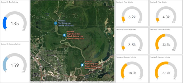
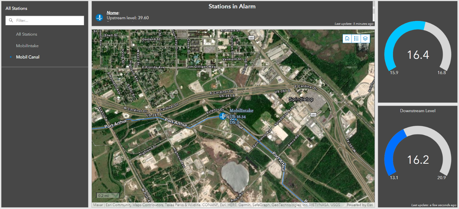
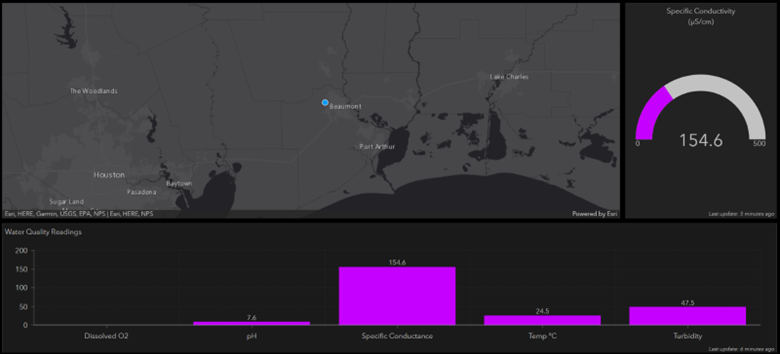
LNVA contracted with NewEdge Services, LLC to provide expertise and troubleshoot the configuration of GeoEvent and the AWS environment. This strategic connection aimed to ensure a smooth and effective implementation of these technologies The collaborative efforts successfully configured GeoEvent to seamlessly ingest the continuous data flow from the stations and publish feature services. These services populate dashboards within LNVA’s ArcGIS Enterprise environment, providing real-time location and readings for each station. This technological advancement empowers LNVA staff to monitor the entire system remotely, eliminating the need for physical visits to the monitoring stations.


Solution
Geospatial Innovation for Water Management: The Transformative Impact of ArcGIS GeoEvent Server at Lower Neches Valley Authority
The implementation of ArcGIS GeoEvent Server at the Lower Neches Valley Authority (LNVA) has proven to be a transformative solution to the challenges faced in monitoring their extensive canal network. LNVA, with a mission to provide a continual and reliable freshwater supply to municipalities, industries, and agriculture, recognized the critical importance of real-time data in managing water quality, levels, and salinity across their 400-mile canal system.
The adoption of a cellular network, despite initial challenges, emerged as a resilient and efficient means of communication with monitoring stations distributed throughout a large service area. The combination of AT&T, AWS, and ESRI further strengthened the system’s reliability and security, overcoming issues such as poor cellular communication and the threat of ransomware attacks. The deployment of a private cellular network and the intentional separation of the AWS Cloud Environment from the city’s primary network exemplify strategic measures taken to safeguard data integrity and enhance cybersecurity.
The expertise brought in from NewEdge Services, LLC played a pivotal role in configuring ArcGIS GeoEvent Server and the AWS environment, ensuring a seamless integration of technologies. The successful implementation now enables LNVA to remotely monitor the entire canal network in real-time, eliminating the challenges associated with manual monitoring, especially during natural disasters that can restrict physical access to monitoring sites.
Looking towards the future, LNVA’s commitment to leveraging technology for data analysis and pattern recognition demonstrates a forward-thinking approach to informed decision-making and system optimization. The extensive dataset generated by the GeoEvent Server holds the potential for uncovering patterns and contributing factors influencing station readings, paving the way for continuous improvements and proactive management.

MORE PROJECTS
Click a project type below to see case studies specifically for that category:


